Posts tagged Google Maps
Map the Distance You Ran or Cycled

Google, for a while now, has had Google Pedometer. Google pedometer is a mapping service that  you use to lay out the course you want or have taken. This way you know how long the trip is.  That way you can see how fast you are going running or Cycling. Its simple to use.

First,  In the 'Jump to' box enter a city to find where you have run or will run.

Second,  Click 'Start recording' and double-click on the map. Start out with Starting point and double-click till you map your route.

There are many numbers available like Mile markers, total distance, and what metric system to use.  Have a nice exercise.

Get notified when Google Maps updates a certain location
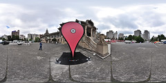
[caption id="" align="alignright" width="240" caption="Image by heiwa4126 via Flickr"]Google Maps Marker in Tokyo[/caption]

Many of the times we are on Google Maps looking if our own house is visible. Unfortunately, they are outdated and not live because of security reasons.  What if you could get notified when a certain aerial image was updated at a certain  point? That would be awesome! So, you did not have to go back constantly to check if it was updated.  If you have a Google account and can click this link , followyourworld.appspot.com you may tell Google to notify you when there is a new image.

It is easy. Just give it the location and an email address.  That is it.